


1
/
of
8
Tread® 2 6” Powersport Navigator
Tread® 2 6” Powersport Navigator
Regular price
$120.99 USD
Regular price
$403.00 USD
Sale price
$120.99 USD
Quantity
Couldn't load pickup availability
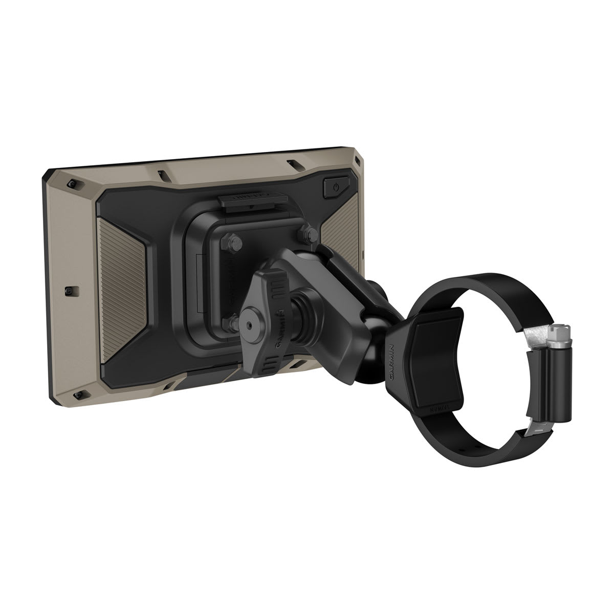
Tread 2 is a rugged Powersport GPS with routes for unpaved roads and trails, snowmobile trails, elevation maps and an IP67 glove-friendly 6” display.
General | |
| Dimension | 6.15"W x 3.5"H x 1"D (15.6 x 8.9 x 2.5 cm) |
|---|---|
| Weight |
12 oz (340 g) |
| Water rating | IPX7 |
| Display Type | multi-touch, glass, high brightness HD color TFT with white backlight |
| Display Size | 5.3"W x 3.0" H (13.3 x 7.5 cm); 6" diag (15.3 cm) |
| Display resolution | 1280 x 720 pixels |
| Dual-orientation display | |
| Tube mount (1.5" - 2.375") | |
| Handlebar mount (up to 1") | yes (smaller tube mount) |
| 1" ball adapter with AMPS plate | |
| Drop rating | MIL-STD-810 |
| Dust rating | IP6X |
| Battery Type | rechargeable lithium-ion |
| Battery life |
up to 7 hours (up to 5 hours at 100% backlight) |
Maps & Memory | |
| Data cards | microSD™ card (not included) |
|---|---|
| Preloaded street maps | |
| High Definition 3D terrain | |
| 3D Terrain | |
| Internal storage | 64 GB |
| Ability to add maps | |
| External memory storage | yes (256 GB max microSD™ card) |
| Includes map updates | |
| Downloadable Satellite Imagery | |
| TOPO map support | |
| Downloadable USGS Quad Sheets | yes (Outdoor Maps+ Subscription) |
Sensors | |
| GPS | |
|---|---|
| Galileo | |
| Barometric altimeter | |
| Compass | |
| 10 Hz multi-GNSS positioning | |
Outdoor Recreation | |
| Point-to-point navigation | |
|---|---|
| Preloaded topographical maps | |
| Preloaded US public land boundaries | |
| Preloaded private land parcel maps | yes (parcels greater than 4 acres) |
| Preloaded USFS Roads and Trails, including motor-vehicle-use-maps for motorcycle, ATV, SXS and full-size 4x4 | |
| Navigate-a-track navigation | |
| Turn-by-turn trail navigation | |
| Compatible with Outdoor Maps+ Subscription | |
Camera Features | |
| Backup camera compatible | yes (BC™ 50 only) |
|---|---|
Navigation Features | |
| Garmin Real Directions™ landmark guidance | |
|---|---|
| TripAdvisor® Traveler Ratings | |
| Route shaping through preferred cities/streets | |
| Includes traffic | yes (with Garmin Tread app) |
| Lane assist with junction view (displays junction signs) | |
| Bluetooth® pairing | yes (works with BLUETOOTH-compatible helmet, headset or smartphone. BLE capable.) |
| Speed limit indicator (displays speed limit for most major roads in the U.S. and Europe) | |
Advanced Features | |
| Smart notifications via app | |
|---|---|
| Wi-Fi® map and software updates | |
| Access to live services via app (traffic, weather, etc.) | |
Motorcycle Features | |
| Control music and media from smartphone or MP3 player | |
|---|---|
| Sunlight readable and weather resistant | |
| Garmin Adventurous Routing™ | |
| Elevation profile | |
| Round trip routing | |
| Custom map support | |
| Wireless ANT+® technology | |
RV Features | |
| Specialized routing for the size and weight of your vehicle | |
|---|---|
| Speed limit changes | |
| Easy Route Planner with GPX file sharing | |
Adventure Features | |
| Pair with compatible inReach® devices | |
|---|---|
| Pair with Garmin PowerSwitch™ digital switch box | |
| Compatible with handlebar controller | |
| Compatible with Group Ride Radio | |
| Group Ride Mobile | yes (with Garmin Tread app) |
| Track recorder (breadcrumbs) | |
| Compatible with the Garmin Tread app for route planning and data management (waypoints, tracks, and routes) | |
| Ultimate Public Campgrounds | |
| Pitch and Roll gauges | |
| Glove-friendly touchscreen | |
Outdoor Applications | |
| Dog tracking | |
|---|---|
Share


Customer reviews
See what customers are saying about this product.
0.0
0 reviews
Loading reviews...
No reviews yet.
Reviews are temporarily unavailable.